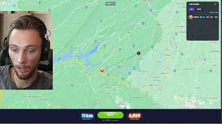
rainbolt looking like a cheater for 8 minutes straight
Комментарии:

Bro could be blindfolded licking a brick and tell you the address of the house it was used for
Ответить
JORDAN PAVEMENT?! SENEGAL GRADIANT?!! Whaaaatttt1ttt!
Ответить
That Senegal gradient always hits different 💀
Ответить
The guy who says “left Twix” and the therapist marks her 191st consecutive correct answer
Ответить
rainbolt is an actual mentat / newtype
Ответить
Cheater
Ответить
IT WAS A BLUR
A BLUR

Cheater
Ответить
For the antartica one, they are on the ocean. The ocean is just frozen over.
Ответить
cheater
Ответить
Bro is literally the server they use to store google map data.
Ответить
cheater
Ответить
Pumpkin eater
Ответить
As a resident of Idaho, I find this video hilarious.
Ответить
If it looks too good to be true, it is.
He's playing off his cheating and you're all just eating it up. He clearly is.

goat
Ответить
Well the only thing here I knew as well was senegal. The only country on geoguessr with that environment color. Pretty recognizable if you have over 50 hours in geo let alone thousands.
Ответить
Rainbolt with literally nothing more than a flat blue color: Guesses the right city
Me with flags and signs prominently in frame: Wrong continent

I'm fully convinced he's cheating because there is no way
Ответить
Would really like to see the world and experience the Senegal Gradient with my own eyes.
Ответить
Just like caseoh guessing which burger brand is it
Ответить
cheater
Ответить
nice job cheat!
Ответить
Someday we might hear in the background “specimen 120 is successful.” Because there is NO WAY this is normal 😭
Ответить
"cheater"
Ответить
CHEATER
Ответить
bro is waiting earth 2
Ответить
rain could get kidnapped in the middle of nowhere and still be right about where he is
Ответить
cheater
Ответить
cheater
Ответить
TECHNICALLY. As long as you know:
-The Date
-The Time of Day
-And the sun's position in the sky relative to the cardinal directions
You can calculate the exact latitude and longitude of any position on the planet.
Latitude, coincidentally, is about the angle of the sun to your position on earth when its at the apex of the arc (at sea level, it varies a bit from elevation of course). When you know the time of day, you know at what "portion" or "percentage" of its arc it should be at. By knowing the date and the cardinals, you know which hemisphere you're at and which latitude sees the sun at that particular angle at that particular time of day (since that varies at any given position only by time of year- since the earth is tilted). Its not so simple as multiplying the latitude by a ratio of the time of day, since the arc isn't linear- you basically need a spreadsheet or a very particular equation.
Longitude is much easier- you just compare where the sun would be at that same time of day and date at the GMT longitude and measure the difference between that and where it is in the image- boom, longitude.
Basically, just write down a matrix of rough reference numbers on a spreadsheet and/or print one out and have it next to you and then all you need to do is figure out what time of day and year it is at the location in geoguesser and you can quickly get a very rough approximation of the location. With that in hand it becomes way easier to pin it down to a specific spot using further context clues.

"obviously Senegal."
Of couuuurse!

Cheater
Ответить
cheater
jk

im curious how much of this he actually knows and how much is sample selection bias
Ответить
cheater
Ответить
Welcome to Secret Service Agency
Ответить
Rainbolt is just god with amnesia so he has foggy memory of the world he created
Ответить
"Senegal...Maybe south of The Gambia" bro wtf
Ответить
cheater
Ответить
"Is this jordan pavement"
LIKE WHAT????

The gradient of Senegal must be a cheatcode
Ответить
I'm starting to think he might be wrong on some of these but the game goes "shit, he must be right, put it there" lol
Ответить
Because his videos are fake. And if you truly think it’s real then you have issues
Ответить
oh i know this cloud, belgian! huh?????????????????????????
Ответить


