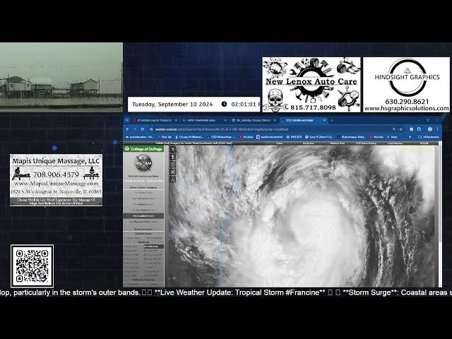
Live from Cocodrie & Dulac, Louisiana! Tropical Storm #Francine!
🌊 I am live from Cocodrie & Dulac, #Louisiana, where we are bracing for significant storm surge—predicted to reach 5-10 FEET or more. As we closely monitor the situation, the models indicate an uptrend in intensification throughout tonight leading up to landfall tomorrow.
🌀 #Francine is on track to become a hurricane today, and the impact could be severe. I will be streaming updates frequently tonight and into tomorrow, ensuring that everyone stays informed about the developments as they unfold.
🔬 In addition to providing real-time updates, I am deploying surge probes to gather critical data during this event. This information will be invaluable for understanding the storm's effects and improving future preparedness efforts.
📡 Stay tuned for live coverage and insights as we navigate this challenging situation together. Your safety is our priority!
#HurricaneFrancine #StormSurge #WeatherUpdate #EmergencyResponse #Louisiana #Cocodrie #Dulac #Louisiana #StormSurge #HurricaneFrancine #HurricaneSeason2024 #WeatherUpdate #LiveReporting #HurricaneWatch #IntensifyingStorm #LandfallAlert #SurgeProbes #SevereWeather #StaySafe #EmergencyPreparedness #CoastalImpact #WeatherForecast #StormChasers #LiveStream #HurricaneTracking #NaturalDisasters #LouisianaWeather #CommunitySafety #FloodingRisk #RealTimeUpdates #ClimateAction #EmergencyResponse #TropicalStorms #WeatherMonitoring #InformedPublic
Комментарии:
Live from Cocodrie & Dulac, Louisiana! Tropical Storm #Francine!
Chicago & Midwest Storm Chasers
How to Manage your Personal & Business Finances - Akash Ladha | WIB Podcast E25
What I'm Building Podcast
Aku Enda Di Ambu (Karaoke) Yaya Chen (Official Music Video)
Syarikat Irama OFFICIAL
BARSCH-BURGER auf dem BOOT selber machen (catch & cook)
Simon von der Bootsschmiede
Evde para kazandiran el işleri #short #shorts
Kitap Kesitleri
Drumming Pug - All Metallica songs in ten minutes
Kiriakos Kazakos
Method Feeder Fishing An Old Mill Lake!
WestysAngling
Burgundy Hair with Haute Kinky Hair
ForeverRikk
50 Plus first weeks pay as a flatbeder
50 Plus Trucker Journey


