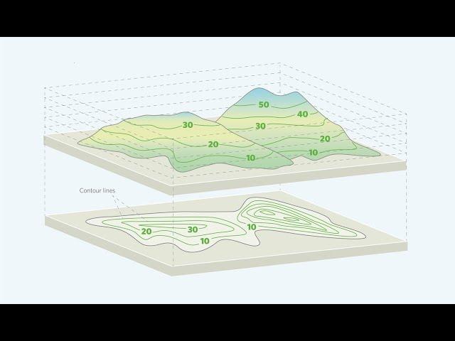
extract contour lines from Google Earth
Комментарии:

Are you serious? The video misses its very point , cause you don't show how to actually then use these magical coordinates to make CONTOUR topography lines. It doesn't teach what to do with and how to obtain the desired result.
Ответить
all the units are metric for this right?
Ответить
How to extract dwg file of these contours?
Ответить
Very nice!!!
Ответить
When I add the layer from the csv file and then click on "XYZ Tiles", I do not see the "ESRI Imagery Satellite" option.
Ответить
How do I get this into leaflet?
Ответить
Thanks for the video. Contour coordinates are coming in latitude and longitude but actually I need in UTM coordinates system (wgs 84).can we get the details from this coordinates. Please help
Ответить
Hi. please help me this problem. i did it like you but it did not show an evaluation after the column of long/lat ? does it a google not good? (i used Giigle pro)
Ответить
Dear Sir,
plases countor volume video create by autolips autocad 2d

I enjoy your tutorials. I noticed my Google Earth Pro has a smaller menu (5 items) with fewer choices than on your video 12 items) - My 5 items are FILE - EDIT - VIEW - ADD - HELP
I was also wondering if there is a simple way to convert Lat-Long into NAD 27 or NAD 83 US Foot Coordinates? Maybe you have a tutorial or consult on this issues. Thank you

hello this is great. i digitized some shapefiles from google earth and imported to arcgis. how can i add contours to the topo map
Ответить
it can make the detail topography? because i tried once but there is difference between the cross section from this contour and the elevation profile in the google earth, what method can we use to get the detail topography? thanks before..
Ответить
I enjoy your tutorials - I've watched a few so far...in this particular example, how can we take this a step further and convert these points into contour maps? If there's a video for that in your collection please point me that way. Thanks!
Ответить


![Murda Beatz - Shopping Spree (feat. Lil Pump & Sheck Wes) [Official Music Video] Murda Beatz - Shopping Spree (feat. Lil Pump & Sheck Wes) [Official Music Video]](https://ruvideo.cc/img/upload/MDIzdXltVWY4U1k.jpg)


