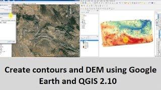
Create contours and DEM using Google Earth and QGIS 2.10
Комментарии:

Tu que se puede poner en catalan que cogenes jjajajjajaj
Ответить
Do you have another link for TCX Converter please? this one couldn't reached ! Thank you>
Ответить
Hi, thanks for the tutorial but I couldn't find the natural neighbour (grid) of SAGA in toolbox of QGIS
Ответить
How do I get this into leaflet?
Ответить
Please how can I generate the maximum annual rainfall data for weather stations in the South-south region of Nigeria through QGIS or from global weather
Ответить
I get an error message that the selected attribute is not numeric, any suggestions how to fix it ??
Ответить
Merci, mais les altitudes obtenues par TCX Converter ne sont pas égales à celles de Google Earth, c'est mieux d'utiliser le site web GPS visualiser pour extraire les élévations
Ответить
how can I do it on Global Mapper 22.0 (64-bit)
Ответить
It works thank you!
To solve the problem "No altitude value appears in TCX Converter...it remains zero" go to
Erik Baník coomment one year ago.

No altitude value appears in TCX Converter...it remains zero..kindly help
Ответить
i did update the Altitude, but it remain zero 0.
Ответить
how to do the same with the seabed?
Ответить
WHAT CONVERTER GOOD FOR WINDOW 10
Ответить
Please provide the tcx converter download link...
Ответить
tcx converter didnt update altitude. in the altitude column says OCTYPE HTML PUBLIC "-//IETF//DTD HTML 2,0//EN">
Ответить
thnq so much, this helped a lot in my final year project
Ответить
hi thanks for the tutorial. But I have a problem with the tcx converter. At the ALT level, instead of having the different altitudes, I rather have '' OCTYPE HT ... '' which is displayed. please, how do I deal with this problem?
Ответить
when i transfere the kml file in TCX converter and correct the the altitude i get something written 'OCTYPE HTML PUBLIC' why is it so can anyone let me know please
Ответить
Please create a tutorial to create watershed delineation.
Ответить
thank you very much, after a big esffort i can do it now, thank you
Ответить
TCX never works can you name a substitute of TCX
Ответить
TCX is troublesome
Ответить
Thank you!
Ответить
ArcGis tutorials
Ответить
Thank you po!
Ответить
how can i add saga tools in Qgis 2.10?
Ответить
IS TCX convertor is a free software???
Ответить
Can you please show how to compute volume from Google Earth into QGIS
?

Hello sir, this matoth is a right,
Ответить
Sir while updating altitude i m not getting any value in that column but ml> is coming. But I not getting why this is coming.
Sir please help me..

Thanks, it's very useful with me
Ответить
Anyone knows the background music?
Ответить
Qgis is shit.
Ответить
TCX Converter updating ml> instead of altitude?
Ответить
how can i add saga tools in Qgis 2.10?
Ответить
"The following layers were not correctly generated." Why can't I run the algorithm? I'm using Google Earth Pro.
Ответить
THANK U
Ответить
I want to get .DEM file as output for map portion. how can this be achieved?
Ответить
thank you soo much, with out speaking you been so effective..
Ответить
WHEN I UPDATE THE ALTITUDE IT SAYS ML.
Ответить
Tried using qgis 3.0.1. When i tried using natural neighbour, an error occured saying the layers were not correctly generated. The solution from the forum doesn't seem to work. Anyone? An absolute newbie here.
Ответить
Arc Gis tutorial by Tania Banerjee
Ответить
Having an Issue to import the file as text layer. QDUS says: "No data found in the file." I followed all steps but the QDIS sorts all data of the CVS (Lat,Lang,ALT + all numbers from left to right. It seems it does not realize that Lat, Land and ALT are the headlines for the columns?! Anyone an idea?
Ответить
"The following layers were not correctly generated" error happend. what to do to solve it?
Ответить
Natural Neighbor tool is giving me an error
'NoneType' object has no attribute 'crs' See log for more details . Can you please help me? Thanks. My QGIS version is 2.18

I cannot proceed creating dem, I have followed carefully but end up the error "'NoneType' object has no attribute 'crs'" please help. thanks
Ответить
Magnifico
Ответить
Very helping tutorial.
Ответить
when i transfere the kml file in TCX converter and correct the the altitude i get something written 'OCTYPE HTML PUBLIC' why is it so can anyone let me know please
Ответить