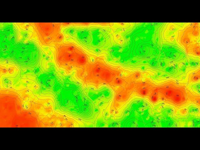
ArcGIS Tutorial - Create DEM and Contours using Google Earth
Комментарии:

thank you so much that was so helpful
Ответить
thank you dear friend
Ответить
❤
Ответить
Its a very useful video.....
I given Rating 4.8out of 5

Great video
Ответить
Thank you so much I wanted to learn how to generate contours but was not getting the right software. This helps me a lot for my thesis. Kudos bruv !
Ответить
what is the unit of the contour lines generated? are they in meters? if not how can I convert it into meters? plz help
Ответить
Thank you so much <3
Ответить
It is in formative and relatively easy to follow.
Ответить
Thank you so much for this!
Ответить
This was so comprehendible!! DEM has never been easier cheesy but true on my part! Thank you!!
Ответить
please guide me why they come wrong. what the problem behind it
Ответить
Hi, why IDW is come wrong please guide me
Ответить
Great video! thank you for this. i keep getting error when i want to convert the gpx to a feature on arcmap, what's the solution
Ответить
Hi could you please help, I cannot carry forward the whole process, every time when I am trying to do that IDW part it gets failed. ERROR 010098 AND 010067 prompt every single time. Could you tell me why is this happening and how can it be resolved?
Ответить
not visible clearly !
Ответить
After opening attributes table all the the elevation are showing as zero. plz help.
Ответить
Awesome video. Thanks for the effort
Ответить
Nice Tutorial, thank you.
(Jan. 19, 2021)

Very useful... i extracted contours for my site.. thank you terra spatial
Ответить
I have a problem with IDW tool. It cannot convert the points to DEM.
Any ideas to fix this?
I've also tried Kringing method with no results. I've seen many people here face this problem.
Could someone help please?

Hi!
While selecting IDW tool, it's showing that "Unable to execute the selected tool, you don't have the necessary license to execute the selected tool. ERROR 010096: There is no Spatial Analyst license currently available or enabled."
How can I fix this?
Please guide me to fix this problem 🙏🙏🙏

rizwan iqbal
Ответить
What does it mean " Your file couldn't be accessed" ?
Ответить
Good job. Thank you so much...
Ответить
Fantastic tutorial, thankyou for your help.
Ответить
Great video! I love to bird sounds in the background as well!
Ответить
when i want to download the gpx file it says that , there is no app associated with the file on my laptop ? what shall I do please?
Ответить
may ask something? my output feature class is the same as the input. how did you change it? i follow all the steps I've seen in the video
Ответить
Sir what to do, my gpx to features tools is not working in arc map
?????

good,, thank you
Ответить
Hi there, I have a quick question. Using your video I was able to extract a DEM and countours using Google Earth. When I am saving the file (to be used in a model later) how do I save just the DEM ? Which file format is best? (We will convert it later for our specific model). Would I save as .tiff? .flt? How would I do this? Thank-you.
Ответить
Can u reply me how to rectify that error
Ответить
After uploading gpx file in conversion tool, it's shows send me error and software itself closes
Ответить
Better check where you can find SRTM DEM of your area from online and generate contour from it. No one can access to Google Earth DEM freely. Elevation given by GPS visualizer is not from Google Earth's DEM, it would rather be from a free DEM like SRTM. GPS visualiser find elevations at each vertex from background DEM and return as GPX. So it wont be any better than original DEM. Just download a SRTM DEM and make contours right away.
Ответить
IDW doesn't open. How to add extension spatial analyst?
Ответить
sir all process done ,but its not visible on screen
Ответить
Hi, do you know what is the resolution of the DEM? Do you consider this FREE DEM source the best one? I need accurate data for a project. Thank you!!!
Ответить
Hello,it says I am not licensed to use the 3D analysis tool.
Ответить
thank you it was in extreme usefullll
Ответить
Really useful tutorial.can you explain how to fix idw error while doing raster interpolation? It shows insufficient points. Thank you 😊
Ответить
My IDW file is failing everytime. I have even restart the arc gis. Please help
Ответить
Well Explained. Thank you.
Ответить
Really thank you so much for this great video
Ответить
👍🏾👍🏾👍🏾
Ответить
And how to impose a shapefile on GPX file that was imported from google earth to ArcGIS
Ответить
sir, please furnish me with
how to create a shapefile that is coordinated and in which coordinate system

Hello! I am repeatedly getting an error message in IDW, showing error 010098: Insufficient number of points, and error:010067: error in executing grid expression. Please guide how to solve this problem.
Ответить
Thanks for the video
Ответить


