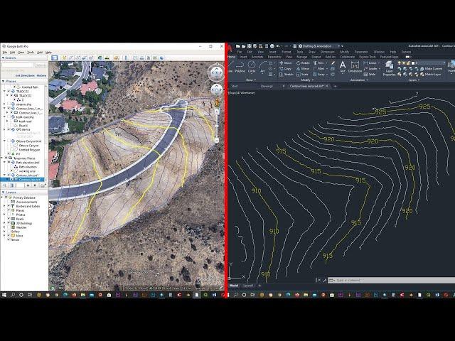
How to extract contour lines from Google Earth To Autocad
Комментарии:

for those who gets the error called : '...The line at line number 1 in file does not appear to contain enough numbers...."
try to follow these steps.
there might be several problems with it as i encountered with,
-your general setting for delimeter should change whatever the text file has. comma(,), or point(.)
-based on general setting, dont forget to check your excel file settings for delimeter
-if still doesnt work ( for me it wasnt) i saved the excel file as normal excel document(.xls thing) then i used online converter to .cvs . I am not sure but i suppose that, normally in excel save as tab, it is written .cvs with comma and that might be problem. But i did all three and tried one by one, last one fixed the problem for me.

tks man for sharing!
Ответить
The generated data from gps visualizer doesn't contain altitudes. Please help me
Ответить
thanks was helpful
Ответить
thank you soooo match
Ответить
🥰🥰🥰🥰
Ответить
the quality is very poor and unclear hard to follow
Ответить
Elevations given by google earth are inaccurate. They are off by +/-300 ft. As a result, any contours based on them are inaccurate too.
Ответить
i get this when trying to open CSV file in quikgrid: "....The line at line number 1 in file does not appear to contain enough numbers...."
Ответить
Thank you very much Bro! you save my day.
Ответить
got it, but the landscape looks far more extreme than it really is
Ответить
I'm getting an error when I try to import the .csv file. The coordinates are -38.443166668;-12.272042933;178.0 and the error is: "The line at line number 1 in file does not appear to contain enough numbers. The line contents are: -38.443166668;-12.272042933;178.0" Do you know what is the problem? negatives coordinates are a problem?
Ответить
unable to get the altitude data , only getting longitudes and latitudes in excel sheet. any solution..?
Ответить
I'll throw this out in case it helps someone else out. It looks like excel365 has several .CSV options. I tied the first that was listed, CSV UTF-8, and I got errors on quickgrid. It looks like you want plan CSV (Comma Delienated). After switching to that the import worked.
Ответить
Is there any way method that DOES NOT use quick grid? I'm able to generate the CSV file but working with a government agency has certain restrictions when it comes to using programs not approved by our IT department.
Ответить
very good video
Ответить
I have a suggestion for you, whatever the command you are providing in dialogue box please zoom there because it is not visible there when the person is watching video through mobile
Ответить
Thank u bro very helpful video thank a lot ❤️❤️❤️
Ответить
Didnt work for me, I followed step by step and I have the same error importing mycvs into quikgrid
Ответить
i need these coordinates in traverse could you help
Ответить
Hi, i make all like in video, but have jast latitude and longitude. without altitude. why?
Ответить
Hi.please can you help me I can't import fron csv to quickgrid
Ответить
THANK YOU!!! Subscribed!!
Ответить
Please can you help me
I can't download quickgrid

Latitude Longitude is not what i need, i need UTM, thats what you selected in Google options settings, but it did not export UTM ((
Ответить
thanks a lot 💕
Ответить
not advisable for precision works.
Ответить
Kak kok aku ga muncul altitudenya yah yg ketinggian meter itu
Ответить
I am not getting the altitudes. Help me out someone.
Ответить
HI, my kml FILE DOES NOT COME WITH ALTITUDE, ALTITUDE IS BLANK ON MY INSTANCE
Ответить
I need your help to resolve a problem with google earth and GPS Visualizer...
when opening my file.kml in GPS Visualizer I don't find altitude data like yours movie !?
thanks in advance

thanks bro...u make me live again huhuhh
Ответить
thank you very much for sharing. morepower ;[]
Ответить
I DONT HAVE THE ALTITUDE .HOW
Ответить
thank you for sharing. for me it only showed the longitude and latitude no altitude, would u know why? thank you<3
Ответить
Brilliant!!! Keep it up. It is useful. Thanks for sharing. :)
Ответить
How do I get the altitude?
Ответить
what kind of car is that
Ответить
Says i dont have enough numbers ... -.-'
Ответить
contour lines too small in autocad
Ответить
legendary tutorial. thankz alot👍👍
Ответить
You saved me, many thanks!
Ответить
i am trying to input my data points in Quickgrid but it is failing, help!!!!!!!
Ответить
This dude probably deserted his channel. He does not reply at all
Ответить
Thanks a lot!!
Ответить
Thanks a lot this is really helpful
Ответить
Please i have problem ( IMPUT DATA HAD LESS THAN 3 data points and was ignored) ?
Ответить
Amazing! Thanks!
Ответить
Hi I'm not getting the altitude while can you give me solution
Ответить
thanks a lot, this was really helpful <3
Ответить
![Dao Episode 47 - [Eng Sub] - Atiqa Odho - Haroon Shahid - Kiran Haq - 24th April 2024 - HAR PAL GEO Dao Episode 47 - [Eng Sub] - Atiqa Odho - Haroon Shahid - Kiran Haq - 24th April 2024 - HAR PAL GEO](https://ruvideo.cc/img/upload/d2w0eGtMamV4dnE.jpg)


