What Can GIS Spatial Analysis Do For Me?
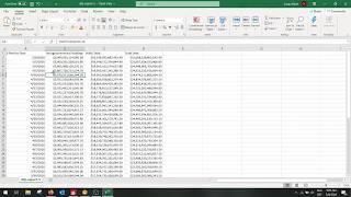
Do you want to be able to make better decisions that lower costs and allow for proactive protection of assets? Do you have trouble visualizing patterns in data when they are in spreadsheets? Spatial analysis answers the question of Where.
Where are my customers? Where are my assets that need replacement? Where can I find a territory to expand into? If you are asking these questions you should be utilizing GIS spatial analysis to answer them.
Start collecting your questions and send them over to me! This channel is made for you and I want to provide answers to your spatial questions in 2020.
Newsletter at https://katiescheurer.com/
Equipment Used:
Canon EOS Rebel T7i https://amzn.to/2O0QJGT
LimaStudio Box Lighting https://amzn.to/2Q7WtRX
Rode Mic https://amzn.to/34SAhiV
ScreenFlow Video Editing https://amzn.to/2pdBqT6
Project Spatial is a community where I lead discussions about GIS strategy and how to plan out a successful geographic information system which increases effective decisions in your company and help further your GIS career. I use affiliate links which means when you purchase from my link I get a small portion of that purchase to help support my channel.
But I can't do this alone. Join the group now by subscribing and sign up for my newsletter at https://katiescheurer.com/ so you never miss a thing!
Katie Scheurer LinkedIn https://www.linkedin.com/in/katie-scheurer/
Тэги:
#arcgis #digital_transformation #esri #geographic #geographic_information_system #geographic_information_systems #geography #geospatial #geospatial_infrastructure #gis #gis_technolgoy #gis_technology #katie_scheurer #location #mapping #maps #project_spatial #spatial #technology #GIS_StrategyКомментарии:
What Can GIS Spatial Analysis Do For Me?
Katie Scheurer
Cenusa, cel mai ieftin îngrășământ natural
Agrointeligenta
Abstract Art Journaling - Art Journaling Ideas, Techniques & Process - “Of Earth & Sky”-#16
Michele Holden Art: Beyond Mixed Media
5 BEST Neighborhoods to Live in Red Deer Alberta
Agent Boomer


![Ye Ali x Dende x Sidney Gilliam - Merlot [Official Video] Ye Ali x Dende x Sidney Gilliam - Merlot [Official Video]](https://ruvideo.cc/img/upload/VVc4X1pQd01DQks.jpg)


