Комментарии:

I really enjoyed watching this video from beginning to end. Really great information, and you did such a good job explaining everything! Collab coming soon???😉
Ответить
Nice video, what do you think about DJI's L2
Ответить
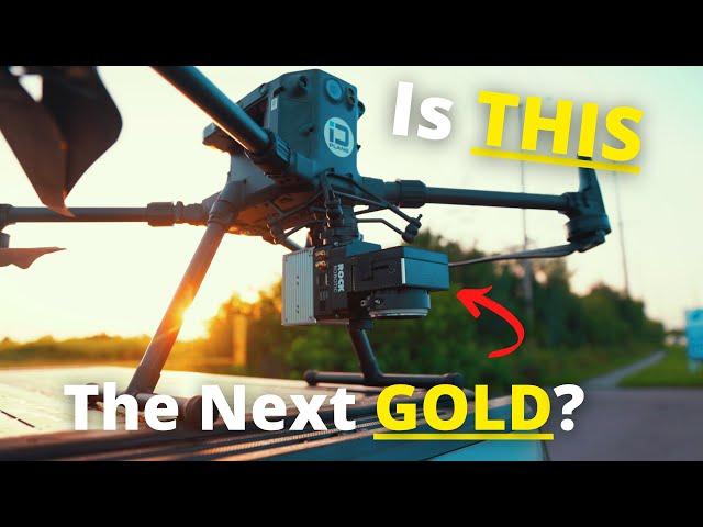
Hello. Great video. I’m not sure why you use both the drtk-2 and the Emlid RS2. If you are running a PPK process with the RS2 why bother with the DRTK-2 as well? I run the L1 on my M300 and I use the RTK on the drone with an NTRIP service. Works great. Really curious why you double up on the RS2 and DRTK-2
Ответить
Well is it?
Ответить
Clients pay for this service This guy I work for willing to pay 20,000.00 -30,000.00 to do LiDAR. Real s**t
Ответить
Any chance you can do a cost breakdown of the end-to-end workflow system and discuss how to charge for projects and what ROI might look like?
Ответить
Wow. I majored in Geography and been doing GIS. I really want to dive into this and start a business.
Ответить
I know it's kind of an older video, but can you do a video where you go really in depth on the differences between some various methods of doing Photogrammetry vs LiDAR, compare results, and how we can get as close to LiDAR using Photogrammetry as possible, which drones would be best for that, etc. I'd love to hear your thoughts and opinions! :) (also, sorry if you already did this video, I'm watching as many as I can but haven't seen one of those yet lol)
Ответить
I've been a fan for the longest I wanted see if you have a program of how to use pix4D mapper i'm trying to start drone mapping since the longest with my mavic 3 classic!
Ответить
complete you sentence in one go
brother

I'd like to see a video of the GNSS setup process.
Ответить
All together that’s like a $80k+ setup no?
Ответить
How exactly does an optical system like LiDAR see through the vegetation?
Ответить
do you need any other certifications outside of the part107
Ответить
Hi, can this be use 4 drones at the same time for scanning?
Ответить
How can I find a pro drone pillow near me ?
Ответить
Question. Do I have to be a licensed land surveyor in order to capture LiDAR? If so, what steps can I take in order to go down this career path?
Ответить
Ok, but is this company that you upload to harvesting and profiting off your hard earned lidar data? All that field work??
Ответить
How many clients do you usually get per month? or year?
Ответить
What do w eneed at least 50 k to do this?
Ответить
Love this video Dylan, thanks for sharing your insights.
Ответить
$50k vs a simple camera on a drone. LiDAR is good, but like u say, it takes gold to purchase it. If you don't mind saying, how much do you charge for a survey, let's say 10 ac track?
Ответить
Is there a good entry level drone with lidar?
Ответить
I really wish you would stop defining photogrammetry so generically. You clearly have no idea of the capabilities/performance of high end professional aerial photogrammetry, and repeatedly class photogrammetry only from the consumer "point and squirt" entry point, which has become popular due to consumer drones and entry level software packages that do little more than render the image over a poor TIN/DEM. Good videos Dylan and again, I congratulate you for doing what you do and love your passion for it... but please, understand there is a vast range in photogrammetry and I've personally used all of it from state-of-the-art (in all it's steps, from the 80's to now) in aerial, satellite, terrestrial, stereo, analytical to digital all the way to multi image, measuring F1 race cars and space craft to tens of microns... MICRONS! Rant over... keep up the good work!
Ответить
Wish I would've been treated more fair by ROCK Robotics but great sensor. 👍
Ответить
spary paint shift?
Ответить
How much you mąkę per year ? Hello from Poland :-)
Ответить
learning a lot from you both , thanks
Ответить
really good video!
coming from normal DJI drones as a videographer, but a drone lidar newbie and guy who is really interested in getting into the space, i would love a more in depth video, where you don't leave stuff out and skip parts - a real step by step video on what i would need to do
also i have trouble understanding a few basics:
1.) you get the ground points via a CAD file you say - how do you know where they are? the ground point tag looks not accurate in the vegetation - i only know the ones on the asphalt
2.) there seem to be two kind of RTKs, one for the drone to get accurate flight paths and the other ones to create points on the map or something? how do i work with RTKs? how do i set those points in the program correctly?
3.) i don't understand what exactly i would give the company in the end? how do you create the so called "finalized deliverables" and how do they look like? what program do you use to make them?
thanks a ton in advance!

Your ONLY 20 Years behind !!! LOL From a Surveyor in the Know !!! Great VIDEO
Thanx
Wile E. Surveyor

Nice Video.
Ответить
Your videos absolutely kill my eyes. Whats up with reds bumped up to the max. Very informative though, thank you
Ответить
Are you still able to do this if you're in an area where GPS head can't get signal?
Ответить
Dylan you have some good videos I like to see more I looking to buy a drone in less a month I like too know if we can get together so I can see a demo.
Ответить
How do you find work in this industry?
Ответить
Is it allowed to fly the heavy matrice in cities in the US? In the EU this is no opportunity whatsoever.
Ответить
Great video. May I suggest you seek out a surveyor to explain some of the details about what this data is. What it’s used for, and how to maintain accuracy.
Ответить
Hello Dylan, I’m sorry to inform you that I believe someone as hacked your channel. If you are this person,and you are reading this,please stop trying to scam me!
Ответить
Dylan, Have you seen that many commenters on this video (including me) have gotten a message from "Dylan Gorman" informing them they just won 2 DJI Mini Pro 3s? The message says to send them a DM on Telegram (a messaging service that it seems all of Russia is using these days). I did so. I got an immediate response asking me for my complete name, email address, mailing address, and cell phone number.
Ответить
Good to know!! Could you make a video on jobs we could get with thermal/LiDAR/P1 camera if we don’t have any certifications/licenses?
Ответить
Really wish my dream profession wasn't 10s of thousands out of reach of me. 23. Getting 107 and starting to get leads as I've been flying hobbiest for 2 years now. Fpv and cini
Ответить
U should try propellers aeropoints. It will make your life way easier.
Basically they are gcp with integrated gps. U just place them switch'em on do ur survey. When finishes the survey ur gcps will have known position.
Give that a try I promise they are worth it

Nice video Dylan. I've been researching Lidar for some time now and even this exact same setup. So how much of a learning curve was it when you got the M300+Lidar? I've done photogrammetry in the past.
Ответить
What are your thoughts on bathymetric lidar? Shallow underwater mapping could be awesome.
Ответить
Great video!! How about accuracy? Is it better than Photogrammetry? For example; to measure a roof of a building, what is best, The lidar solution or Photogrammetry(highend camera like the P1)?
Ответить
What college courses do you need for a drone career in Lidar?
Part 107 licence also?.

Great informative video Dylan. Just out of curiosity, the R2A comes with a 24mp Sony camera integrated into the LIDAR package, why not use the photos captured with that rather than fly a separate mission using the P1? Was that for comparative purposes for those using traditional photogrammetry methods to capture survey data?
Ответить
Good video. I am a surveyor. I hope you are working with or having a surveyor review your work.
Thank You

Do I need a licensed surveyor to sign off on the deliverables if I myself am not a licensed surveyor?
Ответить