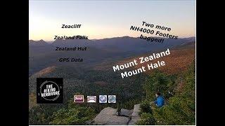
Mount Hale | Mount Zealand | Zeacliff | NH4000 | Hammock Camping
We parked at the Zealand trail head ($5 fee) and road hiked back to the Hale Brook Trail.
We then climbed Mount hale via the Hale Brook Trail, continued on to the Lend-A-Hand Trail past the Zealand Falls hut.
We ended up camping by Zeacliff.
We headed out at 4am and climbed Zealand in the dark to get back to Zeacliff and watch the sunrise!
We then visited the AMC Zealand Falls hut, the Zealand Falls and then Zealand Pond. We hit
Mount Hale
Elevation: 4,055 feet (1,236 meters)
Prominence: 614 feet (187 meters)
Location: Bethlehem, NH (Grafton County, New Hampshire)
Range: Twin Range
Coordinates: 44°13.30′North 71°30.73′West
Rating: How do the ratings work?Easy
Features: Brooks, Cascades, Limited summit views
Mount Zealand
Elevation: 4,260 feet (1,300 meters)
Prominence: What is Prominence? 246 feet (75 meters)
Location: Whitefield, NH, Grafton County
Range: Twin Range
Coordinates: 44°10.78' North 71°31.28' West
Features: Zealand Falls, Zealand Falls Hut, Zeacliff, Zealand
Pond, Beaver Ponds, Zeacliff Pond, Zealand River,
Appalachian Trail
New Hampshire 4,000 footers
New Hampshire 4,000 footers in Winter season
New England 4,000 footers
New England 4,000 footers in Winter season
New Hampshire Hundred Highest
New England Hundred highest
New England Hundred highest in Winter season
Northeast 111
Trailwrights 72 summit club
48x12 "The Grid"
Тэги:
#nh4000 #zealand #zealand_hut #mount_hale #mount_zealand #zeacliff #Zealand_trail #lend_a_hand_trail #hale_brook_trail #twinway #at #zeacliff_trail #zealand_pond #appalachian #appalachian_trail #amc #hut #Zealand_Falls_HutКомментарии:
ASMR FULL BODY MASSAGE FEMALE
Danilo Marzorati Osteopata D.O.
BBOY TAISUKE | THE KING
Pro Bboy Channel
SEASON 21.EXE
gooflol
Aficionados de Honduras estallan en furia luego de derrota humillante contra México
Diario Deportivo Diez
Goloza Music Video Coming Soon_Macedo
Ndzhaka Media
부동산 상담 신청하신 분들의 98%는 '이렇게' 행동합니다.ㅣ이집저집#2
박병찬의 부동산 부자병법
Lograr el cambio para el estilo de vida Max (Francisco Martínez )
MaxfamilyEmprendiendo
Hot Stone Massage Techniques | Massage with Mike
Massage With Mike
Backpacking Day 1 – Mount Hale & Zeacliffs
Fluff BigRollingMarshmallow


